Table of Contents

EXECUTIVE SUMMARY: A Historic Winter Storm Approaches
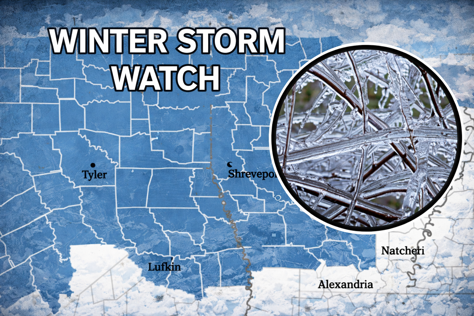
A GREAT WINTER STORM WATCH has been issued for a significant portion of the Central United States, signaling the arrival of what could become one of the most substantial winter weather events in recent years. This impending meteorological powerhouse combines rare atmospheric ingredients to create potentially historic snowfall, dangerous ice accumulation, life-threatening wind chills, and widespread disruption. This comprehensive guide provides essential information about this developing storm system, including detailed regional impacts, precise timing, safety protocols, and preparation strategies. Residents across the affected regions must take this Winter Storm Watch with the utmost seriousness, as conditions may deteriorate rapidly with severe consequences for travel, infrastructure, and personal safety.
PART 1: STORM OVERVIEW AND METEOROLOGICAL SIGNIFICANCE
1.1 What This Winter Storm Watch Means
A Winter Storm Watch is issued by the National Weather Service when there is a potential for significant winter weather including heavy snow, sleet, or freezing rain, typically within 24 to 72 hours. This particular watch, however, carries additional urgency due to several unusual and concerning factors that elevate it beyond typical winter weather advisories.
Key Distinctions of This Watch:
- Geographic Scope: Unusually large affected area spanning multiple states
- Multiple Hazard Types: Simultaneous threats of heavy snow, significant ice accumulation, and blizzard conditions
- Atmospheric Extremes: Exceptionally cold air mass combining with abundant moisture
- Duration: Prolonged precipitation event lasting 24-36+ hours
- Timing: Developing during daylight hours with peak intensity overnight
Elevation to Warning Status: This Winter Storm Watch is expected to be upgraded to a Winter Storm Warning approximately 12-24 hours before onset, with potential Blizzard Warnings for regions where winds exceed 35 mph with falling/blowing snow reducing visibility below ¼ mile for 3+ hours.
1.2 Meteorological Setup: The Perfect Storm Scenario
The impending storm represents a classic but amplified “Panhandle Hook” system—a low-pressure system that develops near the Colorado/Kansas border before tracking southeastward into Oklahoma, then turning northeast toward the Great Lakes. What makes this system particularly dangerous is the collision of three distinct air masses rarely seen with such intensity simultaneously.
Air Mass Convergence:
- Arctic Air Mass: Exceptionally cold air plunging southward from Canada, with origins in the polar region
- Gulf Moisture: Unusually high atmospheric moisture streaming northward from the Gulf of Mexico
- Pacific Influence: Disturbance crossing the Rocky Mountains providing additional lifting mechanism
Temperature Profile Dangers: The vertical temperature structure creates ideal conditions for multiple precipitation types. A layer of above-freezing air between approximately 3,000-6,000 feet (the “warm nose”) will cause snow to partially melt before refreezing near the surface, leading to potentially catastrophic ice accumulation beneath heavier snowfall.
Historical Context: This storm shows similarities to several historic events, including:
- The Groundhog Day Blizzard of 2011 (27+ inches of snow in parts of Oklahoma)
- The Christmas Blizzard of 2009 (hurricane-force winds with heavy snow)
- The December 2000 Ice Storm (600,000+ without power for days/weeks)
However, forecast models suggest this event could exceed these previous storms in combined impacts across a wider geographical area.
PART 2: REGIONAL IMPACT BREAKDOWN
2.1 Primary Impact Zone: Central Plains
Geographic Area: Eastern Colorado, Western Kansas, Oklahoma Panhandle, Northwestern Texas
Key Cities: Amarillo (TX), Dodge City (KS), Guymon (OK), Lamar (CO)
Expected Impacts:
- Snow Accumulation: 12-18 inches with localized amounts exceeding 24 inches
- Wind Speeds: 30-45 mph sustained, gusts to 55+ mph
- Visibility: Frequent whiteout conditions below ¼ mile
- Wind Chills: -15°F to -30°F during and after the storm
- Drifts: 3-6 foot drifts due to sustained winds and light snow density
Timeline: Precipitation begins as snow mid-morning, intensifying through afternoon, with peak intensity evening through overnight. Conditions gradually improve from west to east during the second day.
Critical Concerns: Travel will become impossible. Rural residents may be isolated for days. Power outages likely from combination of snow loading and high winds. Livestock emergency potential in agricultural areas.
2.2 Secondary Impact Zone: Southern Plains
Geographic Area: Central and Eastern Oklahoma, North Texas, Southern Kansas
Key Cities: Oklahoma City (OK), Tulsa (OK), Wichita (KS), Fort Worth (TX)
Expected Impacts:
- Ice Accumulation: 0.25-0.50 inches, with higher amounts possible
- Snow Accumulation: 4-10 inches following ice
- Transition: Rain → Freezing Rain → Sleet → Snow progression
- Winds: 20-35 mph, gusts to 45 mph
- Wind Chills: 0°F to -15°F
Timeline: Rain begins late morning, transitioning to freezing rain by early afternoon. Ice accumulates through evening before changing to sleet, then snow overnight. Precipitation ends mid-morning of second day.
Critical Concerns: Catastrophic power outage potential from ice-loading on power lines and tree limbs. Extremely hazardous travel conditions as ice forms beneath falling precipitation. Weight stress on structures from combined ice and snow.
2.3 Tertiary Impact Zone: Midwest Transition
Geographic Area: Missouri, Southern Iowa, Northern Arkansas, Southern Illinois
Key Cities: Kansas City (MO), Springfield (MO), Des Moines (IA), Fayetteville (AR)
Expected Impacts:
- Mixed Precipitation: All types possible in varying sequences
- Snow Accumulation: 3-8 inches, heaviest northwest
- Ice Accumulation: Up to 0.25 inches, mainly southern areas
- Winds: 15-30 mph
- Temperatures: Rapidly falling during event
Timeline: Precipitation begins as rain or freezing rain afternoon of first day, transitioning to snow overnight, continuing through second day morning.
Critical Concerns: Rapidly changing conditions catching travelers unprepared. Refreezing of melted precipitation as temperatures plummet. Secondary road impacts in rural areas.
PART 3: TIMELINE AND PROGRESSION
3.1 Initial Phase (12-24 Hours Before Precipitation)
Current Conditions: Dry but increasingly cloudy. Winds shifting to northerly. Temperatures beginning gradual fall.
Public Action Phase:
- Finalize Preparations: All storm preparations should be completed
- Travel Adjustments: Cancel or complete non-essential travel
- Information Verification: Confirm multiple reliable information sources
- Communication Plans: Establish family/neighbor check-in protocols
Official Actions:
- Winter Storm Watch remains in effect
- Road treatment crews begin pre-treatment operations
- Emergency management agencies finalize response plans
- Utility companies position response crews
3.2 Onset Phase (First 6 Hours of Precipitation)
Meteorological Conditions: Light precipitation begins. Temperature at or slightly above freezing in many areas, creating false sense of security.
Public Action Phase:
- Avoid Travel: Especially in western regions where snow begins immediately
- Monitor Conditions: Watch for changing precipitation types
- Initial Assessments: Check property for developing issues
- Power Preparedness: Charge essential devices, prepare alternative light/heat sources
Hazard Development:
- Roads become slick, especially bridges and overpasses
- Initial power line icing begins in freezing rain areas
- Visibility reductions in snow areas
- First emergency responses activated
3.3 Intensification Phase (Hours 6-18)
Meteorological Conditions: Precipitation intensity increases. Full transition to winter precipitation types across most areas.
Public Action Phase:
- Shelter in Place: Do not travel under any non-emergency circumstances
- Conserve Resources: Begin prudent use of supplies
- Check Vulnerable Contacts: Ensure elderly/disabled neighbors are safe
- Document Conditions: For insurance purposes if needed
Hazard Escalation:
- Power outages increase in ice-affected regions
- Travel becomes impossible in most areas
- Emergency services may become delayed
- Whiteout conditions develop in blizzard areas
3.4 Peak Intensity Phase (Hours 18-30)
Meteorological Conditions: Heaviest precipitation rates. Strongest winds. Lowest visibility.
Public Action Phase:
- Remain Indoors: Even if conditions appear to temporarily improve
- Conserve Heat: Focus on maintaining core living areas
- Monitor Emergency Channels: For critical updates
- Avoid Unnecessary Risks: No snow clearing during whiteouts or electrical hazards
Maximum Hazards:
- Near-zero visibility in snow regions
- Critical ice accumulation threatening infrastructure
- Emergency services potentially suspended
- Widespread power outages possible
3.5 Winding Down Phase (Hours 30-48)
Meteorological Conditions: Precipitation ends from west to east. Winds gradually diminish. Extreme cold establishes.
Public Action Phase:
- Initial Assessment: Check property for damage when safe
- Travel Restriction Compliance: Heed ongoing travel advisories
- Community Check: Verify safety of immediate neighbors
- Damage Documentation: Photograph any property damage
Post-Storm Hazards:
- Extreme wind chills
- Frozen pipes and water systems
- Snow/ice removal dangers
- Downed power lines
3.6 Recovery Phase (48+ Hours After Onset)
Meteorological Conditions: Clearing skies but dangerously cold. Gradual moderation begins.
Public Action Phase:
- Clearing Operations: Begin safe snow/ice removal
- Damage Reporting: Contact utilities and insurance
- Supply Replenishment: Restock used emergency items
- Community Assistance: Help vulnerable neighbors
Recovery Timeline:
- Primary roads: 12-24 hours to clear
- Secondary roads: 24-72 hours to clear
- Power restoration: 24 hours to multiple days
- Full recovery: Several days to weeks in hardest hit areas
PART 4: PREPARATION AND SAFETY PROTOCOLS
4.1 Essential Home Preparation Checklist
Immediate Actions (Within 12 Hours):
- Water Supply: Fill containers with drinking water (1 gallon per person per day for 3+ days)
- Food Supply: Non-perishable items requiring no cooking/refrigeration
- Medicine: Minimum 7-day supply of essential medications
- Documents: Important papers in waterproof container
- Cash: ATM/credit systems may be unavailable
Home Protection Actions:
- Pipe Insulation: Exposed water pipes in unheated areas
- Window Sealing: Plastic sheeting or weather stripping
- Roof Assessment: Clear gutters and downspouts
- Tree Limbs: Remove those threatening structures or power lines
- Ventilation Clearance: Ensure heating vents/exhausts remain clear
Emergency Equipment Verification:
- Flashlights/Lanterns: With extra batteries
- Weather Radio: Battery-powered or hand-crank NOAA radio
- Alternative Heat: Properly ventilated space heaters or fireplace
- Carbon Monoxide Detectors: Fresh batteries and functionality check
- Fire Extinguishers: Accessible and charged
4.2 Travel Safety: Absolute Guidelines
Pre-Travel Assessment:
- Absolute Necessity: Is travel absolutely required?
- Route Conditions: Check official road condition sources
- Daylight Travel Only: Complete travel before sunset
- Full Fuel Tank: Keep vehicles at least half full
- Communication Plan: Share itinerary and check-in times
Winter Survival Kit (Per Vehicle):
- Warmth: Sleeping bags or blankets for all occupants
- Visibility: Flashlights, flares, reflective triangles
- Traction: Sand, cat litter, or traction mats
- Tools: Snow shovel, ice scraper, jumper cables
- Supplies: Water, non-perishable food, medications
- Communication: Charged phone, charger, power bank
- Safety: First aid kit, knife, whistle
Driving Techniques for Extreme Winter Conditions:
- Speed Reduction: 50%+ reduction on snow/ice
- Following Distance: 8-10 seconds minimum
- Gentle Inputs: No sudden steering, braking, or acceleration
- Bridges First: Elevated surfaces freeze first
- Headlights On: Regardless of time of day
- Stuck Vehicle: Stay with vehicle, run engine sparingly, keep exhaust clear
Abandoning Travel: If conditions deteriorate while traveling, seek shelter immediately rather than pressing forward. Hotels, truck stops, or emergency shelters are safer than stranded vehicles.
4.3 Power Outage Specific Preparations
Before Outage Occurs:
- Device Charging: Phones, tablets, power banks, medical devices
- Refrigerator Management: Set to coldest setting, freeze water containers
- Generator Readiness: Fuel supply, proper outdoor placement, extension cords
- Utility Information: Have account numbers and emergency contacts available
- Manual Operation: Know how to manually open garage doors/operate gates
During Power Outage:
- Food Safety: Keep refrigerator/freezer closed (food safe 4/48 hours respectively)
- Carbon Monoxide Safety: Never use generators/grills indoors or near openings
- Reporting: Contact utility once to report outage, then avoid tying up lines
- Circuit Management: Turn off/unplug sensitive electronics to prevent surge damage
- Layered Clothing: Dress in layers rather than relying solely on alternative heat
After Power Restoration:
- Appliance Reset: Gradually restore power to appliances
- Food Assessment: “When in doubt, throw it out” for refrigerated items
- Damage Inspection: Check for electrical issues before full restoration
- Supply Restocking: Replace used emergency items
- Experience Evaluation: Note improvements for future preparation
4.4 Vulnerable Population Considerations
Elderly/Disabled Individuals:
- Medication Supply: Minimum 7-day supply plus extras if refrigeration needed
- Medical Equipment: Backup power solutions and manual alternatives
- Emergency Contacts: Posted visibly by phones and exits
- Warming Center Information: Locations and transportation options
- Daily Check-Ins: Formalized system with family/neighbors
Families with Infants/Young Children:
- Formula/Diapers: One-week minimum supply
- Safe Sleeping Arrangements: Warm but not overheated environments
- Entertainment Supplies: Books, games, activities for extended indoor time
- Pediatric Emergency Information: Doctor contacts, medications, allergies
- Child Safety: Space heaters and candles completely inaccessible
Livestock/Agricultural Operations:
- Feed Supply: Minimum one-week supply accessible without equipment
- Water Systems: Freeze protection for pipes/troughs, backup water sources
- Shelter Integrity: Windbreaks, roof supports for expected snow loads
- Veterinary Contacts: Emergency numbers, basic treatment supplies
- Equipment Preparation: Fuel, anti-gel additives, block heaters operational
Pet Owners:
- Indoor Accommodation: All pets brought inside well before storm
- Food/Water Supply: One-week minimum for all pets
- Waste Management: Indoor alternatives for normally outdoor pets
- Identification: Current tags and microchips in case of separation
- Emergency Kit: Pet-specific first aid, medications, comfort items
PART 5: HEALTH AND MEDICAL CONSIDERATIONS
5.1 Cold-Related Health Threats
Hypothermia Recognition and Response:
- Early Symptoms: Shivering, confusion, fatigue, slurred speech
- Advanced Symptoms: Loss of coordination, weak pulse, dilated pupils, loss of consciousness
- Immediate Actions:
- Move to warm location
- Remove wet clothing
- Warm center of body first (chest, neck, head, groin)
- Warm beverages if conscious (no alcohol)
- Seek medical attention immediately
Frostbite Prevention and Treatment:
- At-Risk Conditions: Wind chills below -20°F can cause frostbite in under 30 minutes
- Vulnerable Areas: Fingers, toes, nose, ears, cheeks, chin
- Warning Signs: Numbness, white/grayish-yellow skin, firm/waxy skin
- Treatment Protocol:
- Get to warm area (do not walk on frostbitten feet if avoidable)
- Immerse in warm (not hot) water
- Do not rub or use direct heat
- Loosely bandage affected areas
- Seek professional medical care
Carbon Monoxide Poisoning Prevention:
- Common Sources: Generators, grills, camp stoves, gas appliances used indoors
- Symptoms: Headache, dizziness, weakness, nausea, vomiting, confusion
- Prevention Measures:
- Never use fuel-burning devices indoors or in attached garages
- Ensure proper ventilation for all combustion appliances
- Install battery-operated CO detectors on every level
- Test CO detectors monthly, replace batteries annually
5.2 Emergency Medical Access Planning
Hospital/Emergency Service Status:
- Elective Procedures: Likely cancelled or rescheduled
- Staffing Levels: Increased for anticipated higher volumes
- Supply Chains: Secured for extended operations
- Transportation: Ambulance services may be delayed or rerouted
When to Seek Emergency Care vs. Shelter in Place:
- Seek Emergency Care Immediately:
- Chest pain or difficulty breathing
- Stroke symptoms (FAST: Face drooping, Arm weakness, Speech difficulty, Time to call)
- Severe bleeding
- Major trauma
- Severe hypothermia or frostbite
- Carbon monoxide poisoning symptoms
- Manage at Home if Safe:
- Minor injuries
- Controlled chronic conditions
- Mild cold symptoms
- Routine medication refills
Alternative Care Options:
- Telehealth: Virtual appointments for non-emergencies
- Pharmacies: Emergency prescription protocols may be activated
- Urgent Care Centers: May have different accessibility than hospitals
- Neighborhood Resources: Healthcare professionals in your community
Medication and Medical Equipment Management:
- Refill Timing: Obtain at least one-week supply before storm
- Storage Conditions: Know temperature requirements for medications
- Backup Power: For power-dependent medical equipment
- Manual Alternatives: For equipment that typically requires electricity
- Emergency Contacts: Healthcare providers, equipment suppliers, insurance
PART 6: INFRASTRUCTURE AND COMMUNITY IMPACTS
6.1 Utility Service Expectations
Electrical Grid Preparedness:
- Utility Company Actions:
- Mutual aid agreements activated with neighboring regions
- Crews prepositioned in anticipated impact areas
- Communication systems tested for outage reporting
- Tree-trimming teams on standby
- Realistic Restoration Timelines:
- Isolated outages: 4-12 hours
- Scattered outages: 12-24 hours
- Widespread damage: 24-72+ hours
- Critical facilities (hospitals, water plants): Highest priority
Ice Accumulation Impact Scale:
- 0.25 inches: Minor issues, some tree limbs falling
- 0.50 inches: Significant problems expected, extended outages
- 0.75 inches: Catastrophic damage likely, multi-day outages
- 1.00+ inches: Historical damage, weeks for full restoration
Natural Gas Service Considerations:
- Pipeline Pressures: Generally maintained during storms
- Meter Access: Keep gas meters clear of snow/ice accumulation
- Ventilation: Ensure appliance vents remain unobstructed
- Emergency Shutoff: Know location and operation procedures
Water/Sewer Service Continuity:
- Pipe Freezing Prevention: Drip faucets, open cabinet doors
- Water Storage: Fill bathtubs/containers for sanitation use
- Well Pump Preparations: Alternative power if electrically operated
- Sewer Backup Prevention: Reduce water use if power lost to lift stations
6.2 Transportation Infrastructure
Road Treatment Strategies:
- Pre-treatment: Brine application before precipitation
- During Storm: Salt/sand mixtures for traction (limited effectiveness in heavy snow)
- Post-storm: Continued treatment as temperatures plummet
- Clearance Priorities: Emergency routes → Major highways → Secondary roads
Realistic Travel Condition Classifications:
- Travel Advisory: Conditions hazardous, avoid unnecessary travel
- Travel Watch: Conditions dangerous, travel strongly discouraged
- Travel Warning: Conditions extremely dangerous, travel prohibited
- Snow Emergency: Roads closed to all non-emergency vehicles
Public Transportation Impacts:
- Buses: Likely suspended or severely limited
- Trains: Possible delays or cancellations
- Air Travel: Widespread cancellations expected
- School Transportation: Almost certainly cancelled
Personal Vehicle Considerations:
- Parking Locations: Avoid street parking if possible
- Snow Removal Access: Ensure plows can access your street
- Vehicle Preparation: Winter tires, antifreeze, windshield fluid
- Abandonment Decisions: Sometimes safer to abandon vehicle than continue
6.3 Communication Network Reliability
Cellular Network Preparedness:
- Backup Generators: At major cell sites
- Fuel Supplies: For extended operation
- Network Prioritization: Emergency communications may receive priority
- Portable Cells: May be deployed to critical areas
Communication Redundancy Planning:
- Landline Phones: Corded phones (not cordless) as backup
- Text Messaging: Often works when voice calls fail during congestion
- Social Media: Official accounts for updates
- NOAA Weather Radio: Fail-safe information source
- Neighborhood Networks: Established check-in systems
Information Verification Protocols:
- Official Sources Only: National Weather Service, emergency management
- Rumor Control: Verify before sharing information
- Update Frequency: Regular but not excessive checking
- Multiple Channels: Different sources for confirmation
PART 7: RECOVERY AND AFTERMATH PLANNING
7.1 Immediate Post-Storm Actions
Safety Assessment Protocol:
- Structural Inspection: Check for ice/snow load damage
- Utility Assessment: Look for downed lines (always assume live)
- Tree Damage: Identify hanging limbs or compromised trees
- Access Routes: Clear paths for emergency services if needed
- Neighbor Welfare: Check on those nearby if safe to do so
Damage Documentation for Insurance:
- Photographic Evidence: Date-stamped photos of all damage
- Temporary Repairs: Document emergency repairs with receipts
- Living Expenses: Keep receipts for additional costs
- Adjuster Communication: Record all conversations and timelines
- Claim Filing: Begin process as soon as practical
Community Coordination Efforts:
- Neighborhood Canvassing: Organized check of vulnerable residents
- Resource Sharing: Coordination of equipment and supplies
- Information Clearinghouse: Central point for updates
- Volunteer Management: Organized assistance efforts
7.2 Long-Term Recovery Considerations
Mental Health and Community Resilience:
- Storm-Related Stress: Recognition and coping strategies
- Community Bonding: Shared experiences can strengthen ties
- Vulnerable Monitoring: Continued check-ins after immediate danger passes
- Support Services: Awareness of available counseling resources
- Recovery Milestones: Celebrating progress toward normalcy
Infrastructure Hardening for Future Events:
- Utility Grid Improvements: Discussions with providers
- Tree Management Plans: Addressing hazardous vegetation
- Communication Redundancy: Investments in backup systems
- Emergency Response Coordination: Improved planning based on lessons learned
- Individual Preparedness: Enhanced personal and family plans
Economic Recovery Support:
- Small Business Assistance: Programs for affected businesses
- Agricultural Disaster Relief: Resources for farming operations
- Insurance Navigation: Assistance with claims processes
- Employment Impacts: Support for disrupted work situations
- Community Resources: Local organizations providing assistance
PART 8: OFFICIAL RESOURCES AND COMMUNICATION CHANNELS
8.1 Critical Contact Information
Emergency Services:
- Life-Threatening Emergencies: 911
- Non-Emergency Police: Local department numbers
- Road Conditions: State Department of Transportation
- Power Outages: Local utility companies
- Gas Emergencies: Local gas company or 911
Government Resources:
- State Emergency Management: Official state agency
- County Emergency Management: Local coordination
- 2-1-1 Services: Comprehensive resource referral
- American Red Cross: Disaster response and shelters
- FEMA Assistance: Federal disaster resources
Utility Companies (Examples):
- Electrical Providers: Local company emergency lines
- Natural Gas Companies: Emergency contact numbers
- Water/Sewer Departments: Local service providers
- Telecommunications: Service outage reporting
8.2 Trusted Information Sources
Meteorological Information:
- National Weather Service: Official forecasts and warnings
- Local Weather Service Offices: Regional specific information
- NOAA Weather Radio: Continuous updates
- Meteorologists: Trusted local media forecasters
Emergency Management Channels:
- Emergency Alert System: Broadcast media interruptions
- Wireless Emergency Alerts: Cell phone notifications
- Local Government Websites: Official updates
- Social Media: Verified official accounts only
Community Information Networks:
- Neighborhood Associations: Local coordination
- Faith Communities: Organized assistance networks
- School Notification Systems: Parent communication channels
- Workplace Emergency Plans: Employer communication
CONCLUSION: FACING THE STORM WITH PREPARATION AND COMMUNITY
Final Assessment and Urgent Recommendations
This GREAT WINTER STORM WATCH represents a serious threat that demands immediate attention and preparation. The combination of multiple hazard types—heavy snow, significant ice accumulation, dangerous winds, and extreme cold—creates a particularly dangerous scenario that exceeds typical winter weather events.
Priority Actions in the Final Hours Before the Storm:
- Complete All Preparations: No aspect of preparation should be left for later. Assume conditions will deteriorate faster than forecast.
- Establish Communication Plans: Ensure all household members know protocols for checking in, sheltering, and emergency communication.
- Secure Vulnerable Items: Protect property that could be damaged by snow, ice, or wind.
- Finalize Alternative Arrangements: For those with special medical needs, childcare requirements, or other unique circumstances.
- Mental Preparation: Acknowledge the seriousness of the situation while maintaining calm and rational decision-making.
The Community Imperative
Winter storms test not just individual preparedness but community resilience. Historical weather events consistently demonstrate that communities that prepare together, check on vulnerable members, share resources appropriately, and maintain clear communication fare better during and after significant weather events.
Community Actions That Make a Difference:
- Organized neighborhood check-in systems
- Shared snow removal equipment and labor
- Resource pooling for vulnerable residents
- Clear communication channels for assistance requests
- Respect for emergency personnel and utility workers
Remembering What Matters
While property damage and inconvenience are significant concerns during winter storms, human safety remains paramount. Material possessions can be replaced; lives cannot. The decisions made in preparation for and during this storm should prioritize the safety of yourself, your family, and your community above all else.
Looking Beyond the Storm
Recovery from a significant winter storm is a process that unfolds in stages. Immediate safety concerns give way to restoration of services, followed by cleanup, repair, and ultimately a return to normalcy. Each phase requires patience, persistence, and continued caution as new hazards emerge even as initial dangers recede.
Final Weather Outlook
Based on the latest forecast models and atmospheric analysis, this storm system has the potential to be a historic event for portions of the Central United States. While exact accumulation amounts and impacts will vary by location, all residents within the watch area should prepare for significant disruption and potentially dangerous conditions lasting 24-48 hours with extended recovery periods.
Stay safe, stay informed, stay prepared, and remember that we weather these challenges best when we work together as individuals, families, and communities.
OFFICIAL WINTER STORM WATCH STATEMENT (Summary):
Conditions are favorable for a significant winter storm to impact the region beginning [Time/Date]. Heavy snow, sleet, and freezing rain are possible, along with strong winds and dangerously cold temperatures. Travel may become difficult or impossible. Prepare now for potential power outages and extended isolation. Monitor later forecasts for updates and possible warnings.